It's too early to say if those dreams may be realized, but conditions are expected to be in place for storms in the days before, during and after Dec. 25, according to the latest long-range outlook.
The last time the tristate area saw significant snowfall on Christmas Day was 2002, when about 5 inches accumulated. In 2009, much of the region saw 1 to 2 inches of snowfall. Since 1912, there has been at least an inch of snow on the ground in Central Park on Christmas Day 18 times, or once every six years.
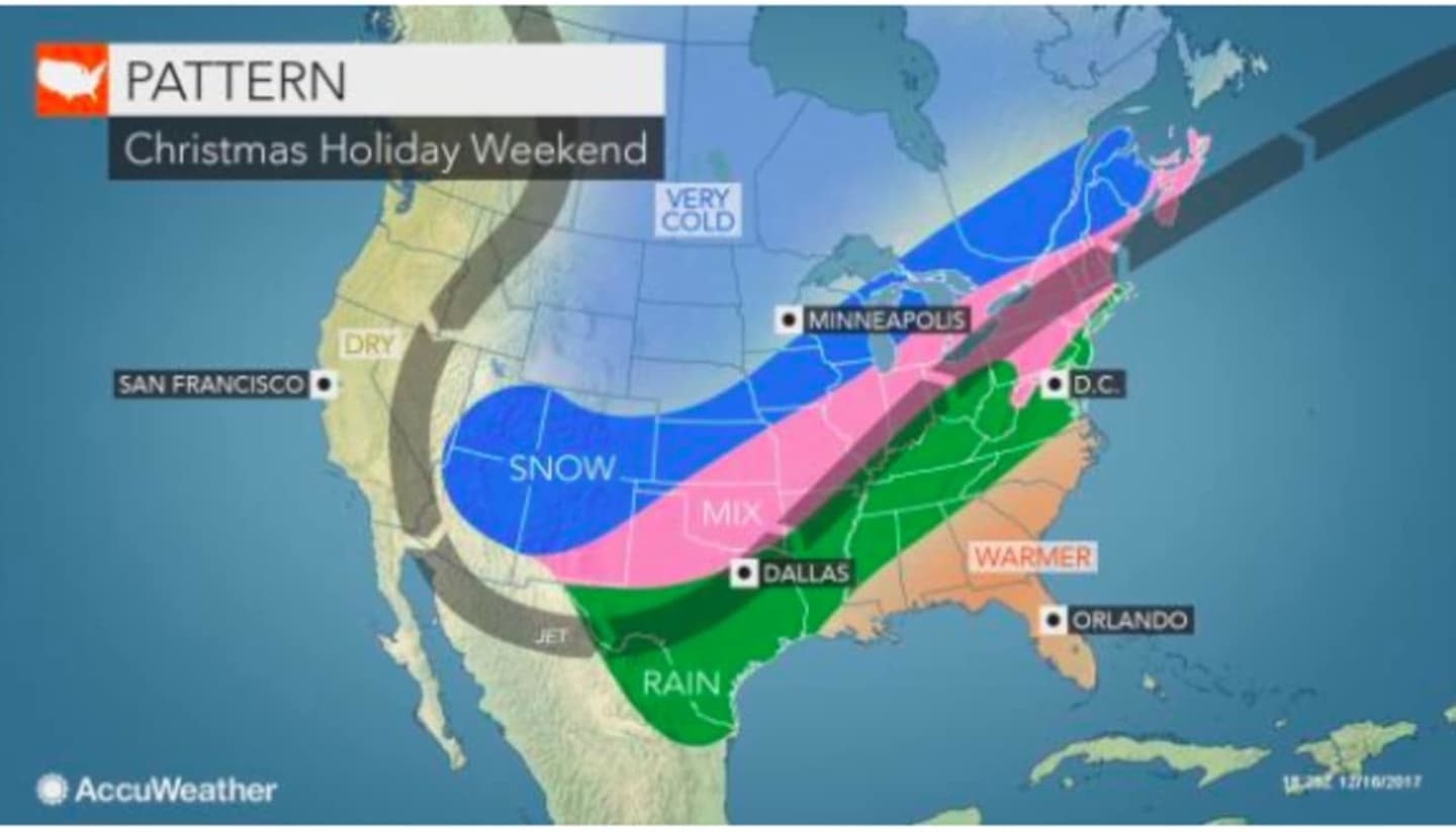
"There are signs of a bad holiday season for traveling by car or air from the Rockies to parts of Plains, Midwest and Northeast during this period," according to AccuWeather Lead Long-Range Meteorologist Paul Pastelok.
Motorists may face wintry road conditions along vast stretches of interstate highways during that time, said AccuWeather.
After a five-day stretch of Arctic air, the tristate area will see milder temperatures this week, with daytime highs climbing into the upper 40s by Tuesday.
But that will be followed by stormy weather around Christmas time. The question is whether the temperatures will be at or around the freezing mark.
"At this time, we think that rain is most likely for much of the mid-Atlantic to southern New England with the storm(s) spanning Dec. 24 to 28," Pastelok said. "However, as cold air sinks southward, some snow and ice are likely from parts of northern New England to the Ohio Valley and southern Plains."
Check back to Daily Voice for updates.
Click here to follow Daily Voice Ossining and receive free news updates.