

As one of the most powerful and potentially catastrophic hurricanes to ever hit the United States closes in on southern Florida, an updated time frame for Irma's impact on the East Coast has been released.
The eye of Category 5 Irma should continue to move between Hispaniola and the Turks and Caicos Islands Thursday evening. The core of the hurricane will then move between the north coast of Cuba and the Bahamas during the next day or two, according to the National Hurricane Center.
Maximum sustained winds remain near 175 miles per hour with higher gusts.
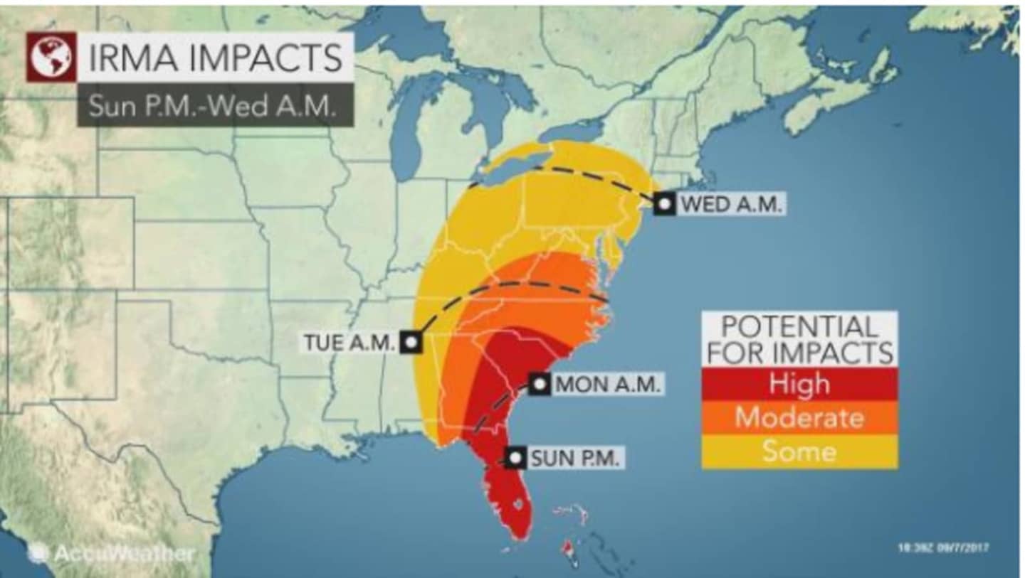
After blasting the northern Caribbean, it will turn toward Florida, unleashing destructive winds, flooding rain and dangerous storm surges across Florida starting early Sunday morning, according to AccuWeather.com.
"Unfortunately, there is no way the United States is going to avoid another catastrophic weather event," Dr. Joel N. Myers, founder, president and chairman of AccuWeather said.
"There will be massive damage in Florida," Myers added, saying Irma will be "the worst single hurricane to hit Florida since Hurricane Andrew in 1992."
The current track of Irma will bring the most severe impacts to the eastern side of the state, including Miami, West Palm Beach, Melbourne, Daytona Beach and Jacksonville, AccuWeather said.
After barreling through Florida, Irma is expected to go from a Cat 5 storm to Cat 4 midway through the state and then Cat 3 as it approaches the Georgia state line. By the time it moves through Georgia overnight Sunday into Monday. It will then become a Tropical Storm, then Tropical Depression with its impact finally being felt in the Hudson Valley next Wednesday in the form of rain.
The rain is not expected to be torrential at this time, but changes in the path of Irma could alter that expectation.
Check back to Daily Voice for updates.
Click here to follow Daily Voice Ossining and receive free news updates.